In April 2024, Alex Baumgard of BGC Engineering presented a paper written by him and Katie Burkell of Cambio Earth Systems titled “The Use of Advanced Geohazard Management Software to Incorporate Real-Time and Near-Time Data into Decision Making” at the 19th Pipeline Technology Conference (PTC) in Berlin.
Over the past two decades, geohazard management has become integral to pipeline operations. Initial programs relied on Geographic Information Systems (GIS) software but lacked comprehensive hazard analysis. Early geohazard management software aimed to centralize hazard information to ensure consistent assessments however, mainly contained tabular data and relied on manual data inputs.
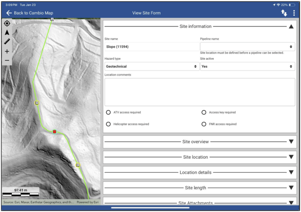
The paper details advancements in data collection that simplify the integration of diverse datasets into geohazard management systems. Examples include real-time weather data, remote sensing data, geotechnical instruments, and strain data. With easier data collection, effective data management and analysis are essential.
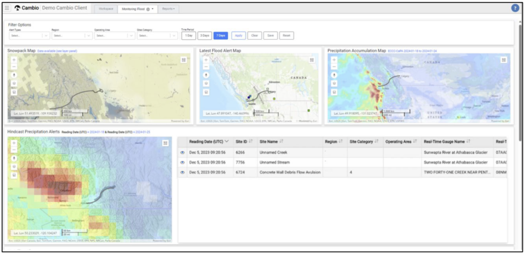
Baumgard and Burkell illustrate the improvements in geohazard management software, which now better integrates and presents visualized data for more insightful and automated analytics. This enables operators to concentrate efforts on critical pipeline sections. The software can integrate thresholds and can monitor and detect exceedances anomalies such as excessive precipitation, high stream flows snowpack, flooding, forest fires, and ground movements, and it facilitates analysis of remote sensing data, strain data and instrumentation data analysis of instrumentation data alongside other sources like ILI tool strain data and Lidar change detection.
The paper highlights how advancements in real-time and near-time weather and earth-sensing data, including geotechnical instrumentation and remote sensing data, have transformed how pipeline operators manage geohazards. Traditional methods like basic GIS and ground inspections are now supplemented by near real-time flood, precipitation and seismic monitoring, precise ground monitoring through Lidar and InSAR, and advanced instrumentation data.
CambioTM is an example of a new generation of advanced geohazard management software that can centralize and manage massive amounts of real-time and near-real-time data. This software enables collaborative work among project teams and transforms data into actionable insights for informed decision-making. Features of this software include live monitoring, cloud storage, remote sensing data integration, machine learning, and enhanced visualization.
Baumgard and Burkell conclude by underscoring the transformative impact of real-time data on geohazard management and how it enables more risk-informed decisions. Advanced geohazard management software is crucial for integrating with various earth science datasets and providing timely access to information for proactive geohazard management.